Title pages, headings and letterforms clipped, cropped and isolated
from maps and map publications issued between about 1880 and 1920.
from maps and map publications issued between about 1880 and 1920.
"D. A. Sanborn, a young surveyor from Somerville, Massachusetts, was engaged in 1866 by the Aetna Insurance Company to prepare insurance maps for several cities in Tennessee. [..] Before working for Aetna, Sanborn conducted surveys and compiled an atlas of the city of Boston titled 'Insurance Map of Boston, Volume 1, 1867'. [..] The atlas includes twenty-nine large plates showing sections of Boston at the scale of 50 feet to an inch. It is believed to include the earliest insurance maps published by Sanborn.
The success of the Boston atlas and the commission from Aetna must have impressed the young surveyor with the importance of detailed and specialized maps for the fire insurance industry. Following his assignment in Tennessee for Aetna, he established the D. A. Sanborn National Insurance Diagram Bureau in New York City in 1867. 11 From this modest beginning grew the specialized company that has compiled and published maps for the fire insurance industry for more than a hundred years." [source]

Albany, Georgia - April, 1920

Allentown, Pennsylvania - March 1885
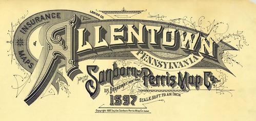
Allentown, Pennsylvania - 1897
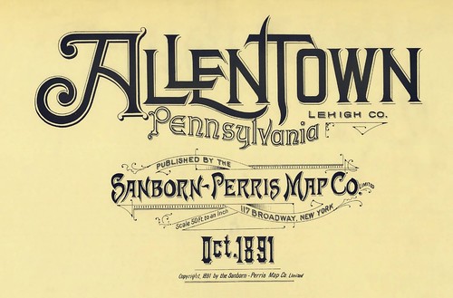
Allentown, Pennsylvania - October, 1891
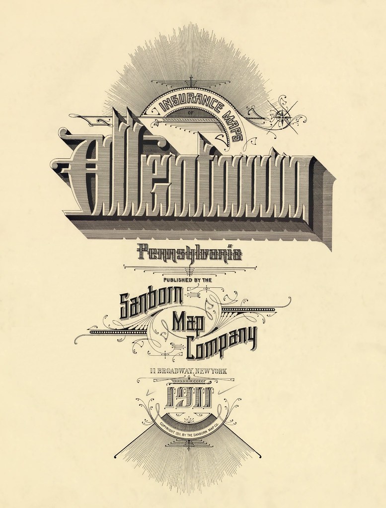
Allentown, Pennsylvania - 1911
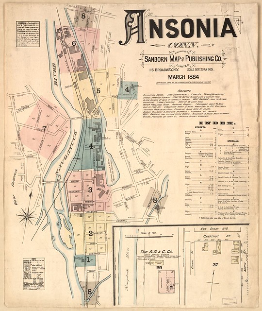
Ansonia, Connecticut - 1884
[example full map]
[example full map]

Aspen, Colorado - February, 1893
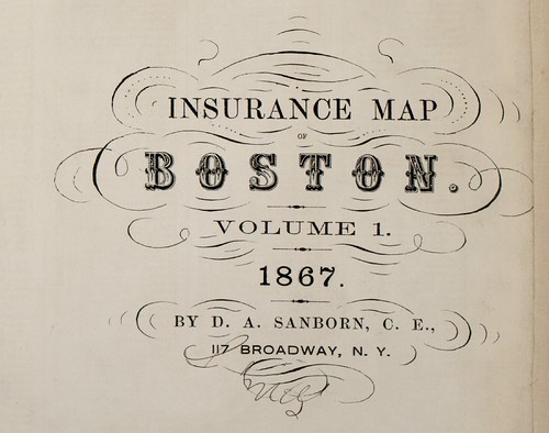
Boston, Massachusetts - 1867

Brunswick, Georgia - July, 1920

Charlottesville, Virginia - October, 1907
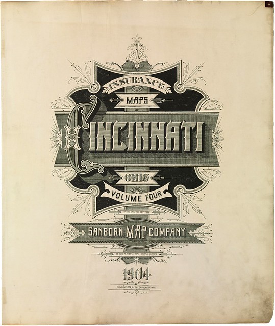
Cincinnati, Ohio - 1904

Colorado Springs, Colorado - 1907
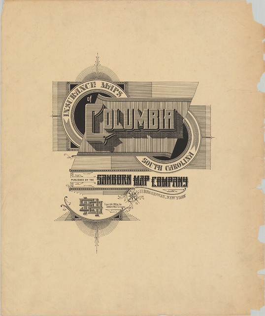
Columbia, South Carolina - June, 1919


Denver, Colorado - 1887
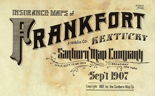
Frankfort, Kentucky - September, 1907
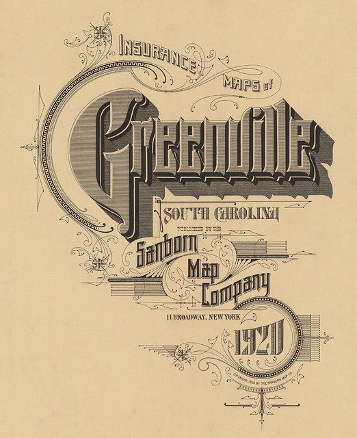
Greenville, South Carolina - June 1920
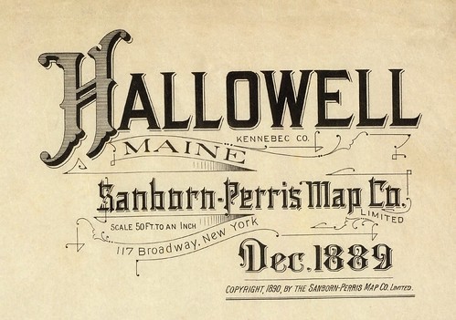
Hallowell, Maine - December, 1889
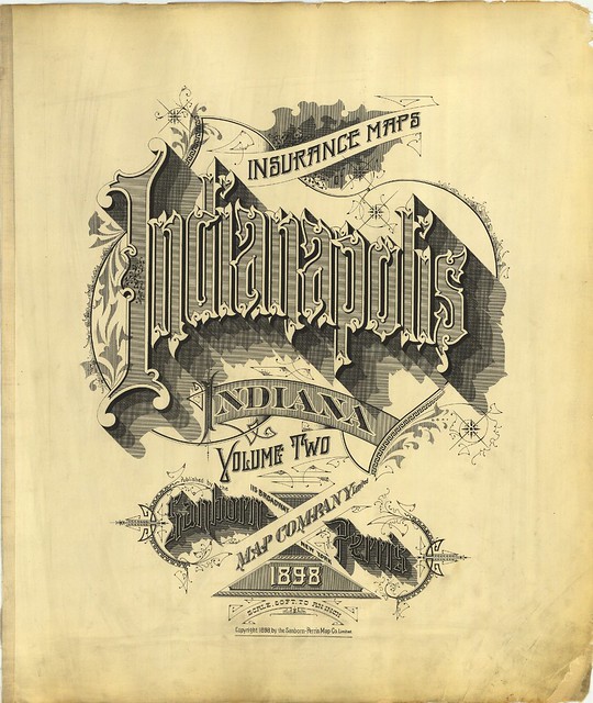
Indianapolis, Indiana - 1898
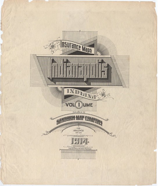
Indianapolis, Indiana - 1914
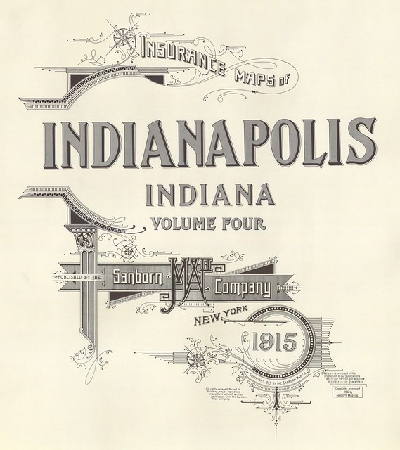
Indianapolis, Indiana - 1915
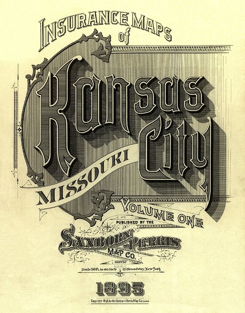
Kansas City, Missouri - December, 1895
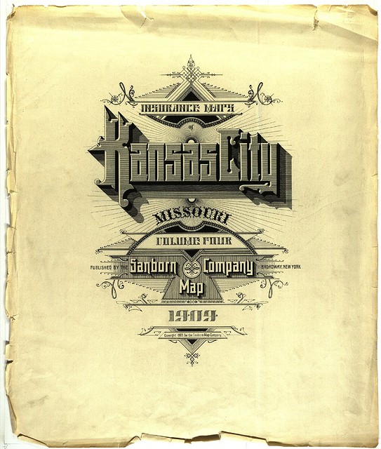
Kansas City, Missouri - July, 1909
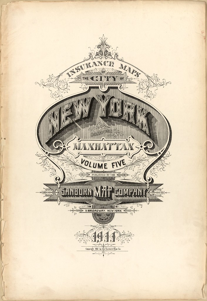
Manhattan, New York - 1911
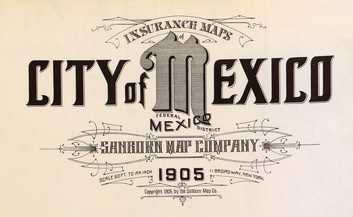
Mexico City, Mexico - 1905
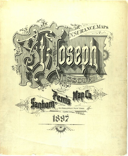
St Joseph, Missouri - February, 1897
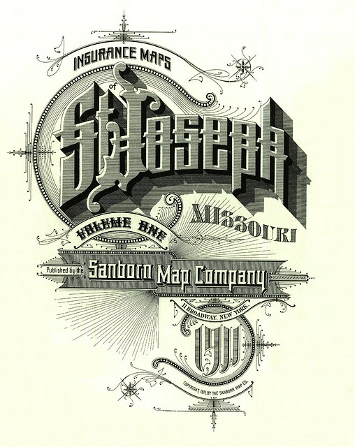
St Joseph, Missouri - September, 1911
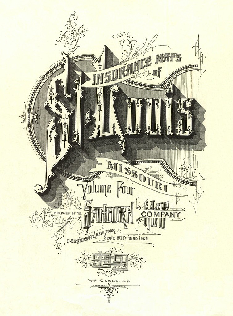
St Louis, Missouri - August, 1909
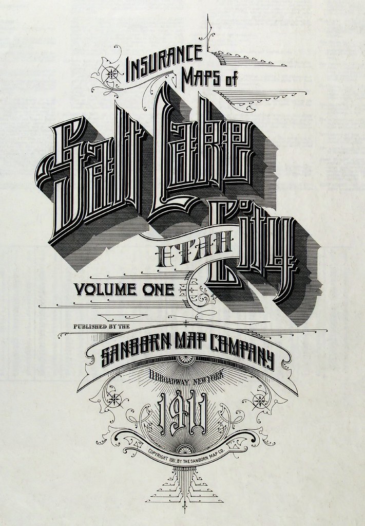
Salt Lake City, Utah - 1911
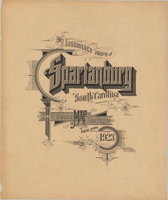
Spartanburg, South Carolina - 1923
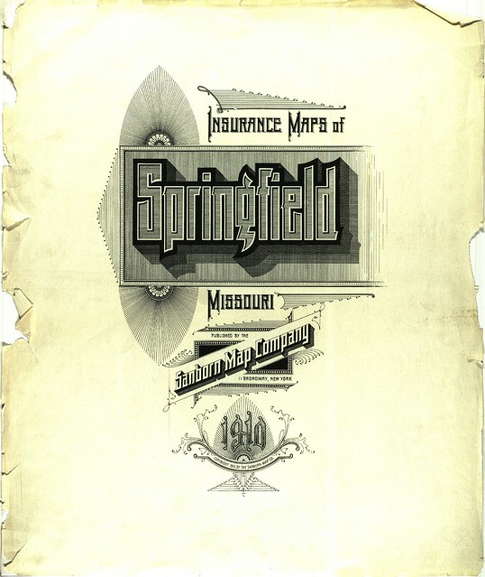
Springfield, Missouri - 1910
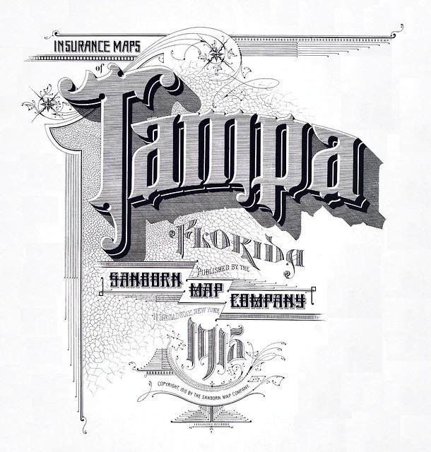
Tampa, Florida - 1915

Thomasaville, Georgia - May, 1920
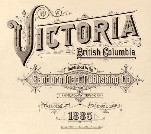
Victoria, British Columbia (Canada) - 1885
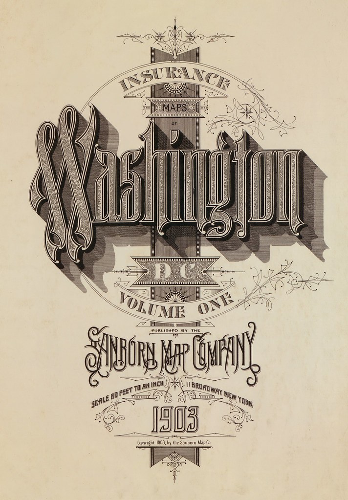
Washington DC - 1903
[Click through for large, and often very large, versions. All images above have been fairly extensively background cleaned of stains, stamps and age-related wear and tear (especially those that remain fairly dirty, following the "less is best" restoration motto)]
Sanborn's fire insurance enterprise produced not only excellent and detailed urban maps, but they also maintained an elegant aesthetic in the headings and legends on the maps themselves, and in the title pages of the (larger) city volumes. The ornamental flair is diverse - I don't think any of the examples above repeat type styles - and lends an air of individuality and refinement to each of the towns surveyed.
Although this sort of artistic embellishment was unlikely to have increased map sales on its own, it's a charming addition which will have perhaps made the purchasers feel a sense of pride and a little more secure about their own unique town. And it's certainly in keeping with the cartographic tradition of decorative trimmings.
There are no comprehensive open portals to the Sanborn fire insurance maps. The images above were obtained from many sources, beginning with the links attached to the Wikipedia Sanborn Maps article.
The Library of Congress has a fairly large site devoted to the subject, but there are only a minimal number of accessible maps.
The LoC collection is, however, available via institutional subscription: "ProQuest Information and Learning's Digital Sanborn Maps, 1867-1970 provides academic and public libraries digital access to more than 660,000 large-scale maps of more than 12,000 American towns and cities"
In digitising their collection in 2002
"Copyright Issues:
No discussion of digital projects is complete without tiptoeing into the quagmire of intellectual property law. The Sanborn Library, LLC owns the largest and most complete collection (over 1.2 million) of historical Sanborn Maps™, and copies from that collection are sold through Environmental Data Resources Inc.9 Prior to beginning our project, Marriott Library Assistant Director for Special Collections, Walter Jones, contacted the Sanborn Library, LLC and requested permission to scan and post all 3,000 maps of Utah in our collection. Permission was denied, and we limited our scanning to those maps in the public domain, i.e., through 1922. There may be hope for scanning more maps, however, as current law states that materials published from 1923-1963 and whose copyright was not renewed are now in the public domain.10
After the digital collection was posted, The Sanborn Library LLC informed us that even the terms "Sanborn" and "Sanborn Maps" are registered trademarks of The Sanborn Library, LLC and that we were required to insert trademark symbols on every occurrence of those words on our website, as well as a statement of that ownership on our main page. We complied."
- Sanborn still exists. They don't follow BibliOdyssey, but maybe you should.
- Previously in a general sense: calligraphy (another of the 'close enough is good enough' tags from the BibliOdyssey delicious bookmarks).