18th and 19th century Japanese world maps.
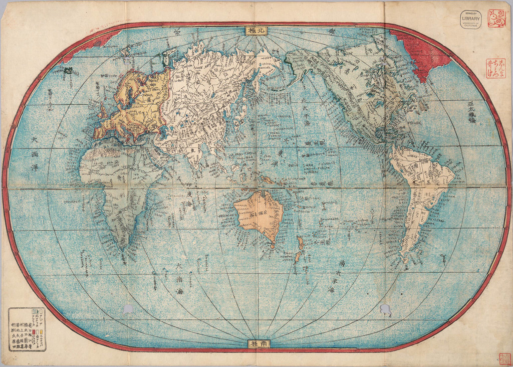
 Bankoku sokaizu / Ishikawa-shi Toshiyuki. Hoei 5 [1708]
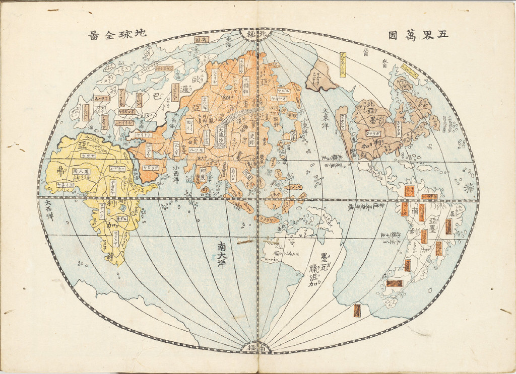
 Oranda shinyaku chikyu zenzu / Hashimoto Naomasa Hakubin. Kansei 8 [1796]
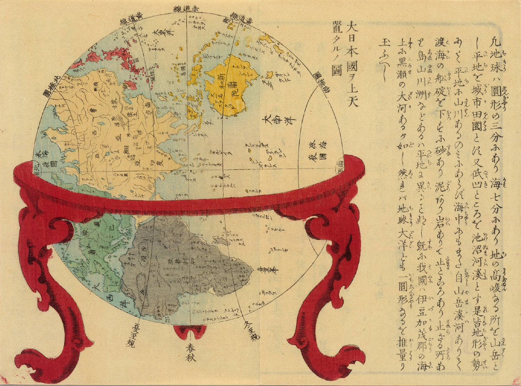
 Dai Nihon yochi benran / Giko Yamazaki. Tenpo 5 [1834]
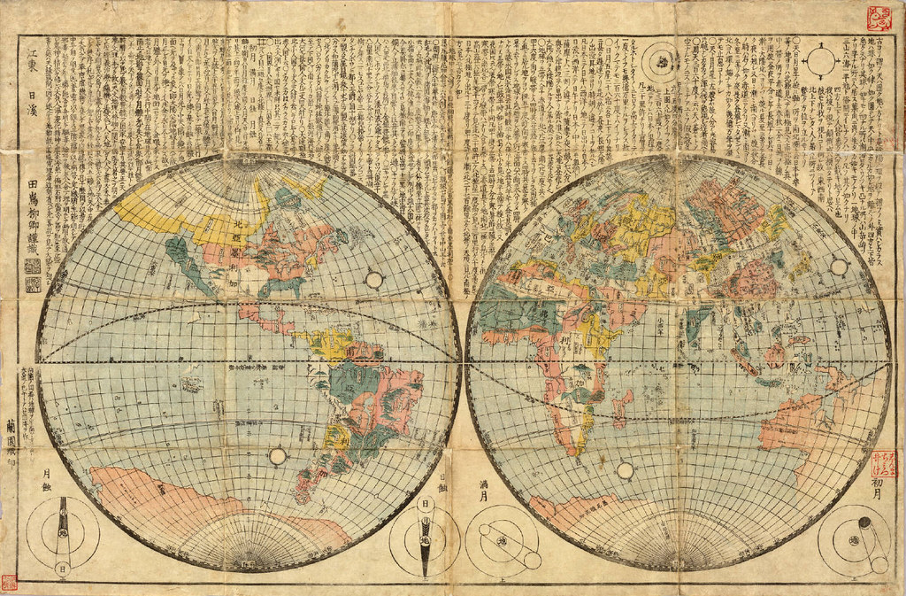 [Oranda Chikyu zenzu : kan] / Tajima Ryukei. [between 1840 and 1868]
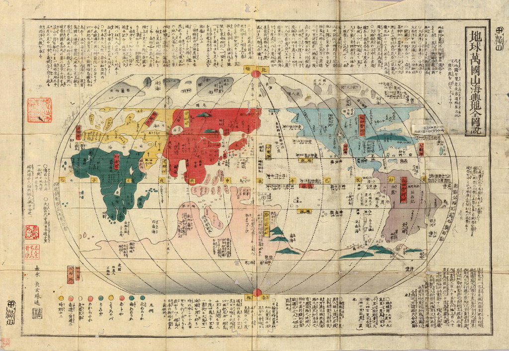 Chikyu bankoku sankai yochi zenzu / Sekisui Cho Harutaka [c. 1850]
 Shochu bankoku zu / Kudo Tohe, Kaei 6 [1853]
 Shintei - chikyu bankoku hozu. Unknown cartographer. Kaei 6 [1853]
 Bankoku chikyu zu: zen / Mineta Fuko cho; Hashimoto Gyokuran mo; Murakami Goyu sho [c. 1853]
 Bankoku chikyu bunzu : zen / Hashimoto Gyokuran. [between 1856 and 1868]
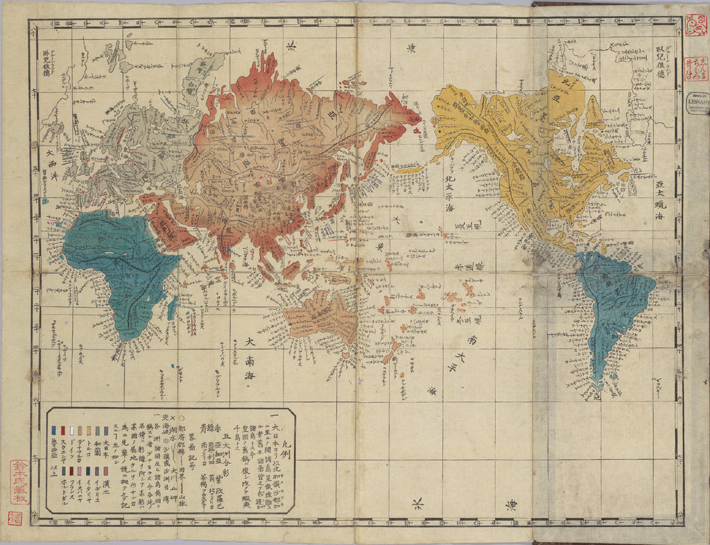 Sekai zu. Unknown cartographer. [c. 1860]
  Shinkoku shochu kokai sekai zenzu / shukuzu Garyuken. Meiji 6 [1873]
 Ansha sekai chizu : Higashihankyu no bu Nishihankyu no bu kan / koku Fukutomi Seisui : Fukutomi Seiri. Meiji 7 [1874]
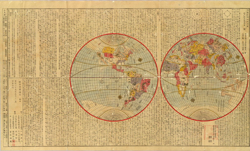
 Shinsen bankoku zenzu : zen / Sakai Sutehiko. Meiji 18 [1885]
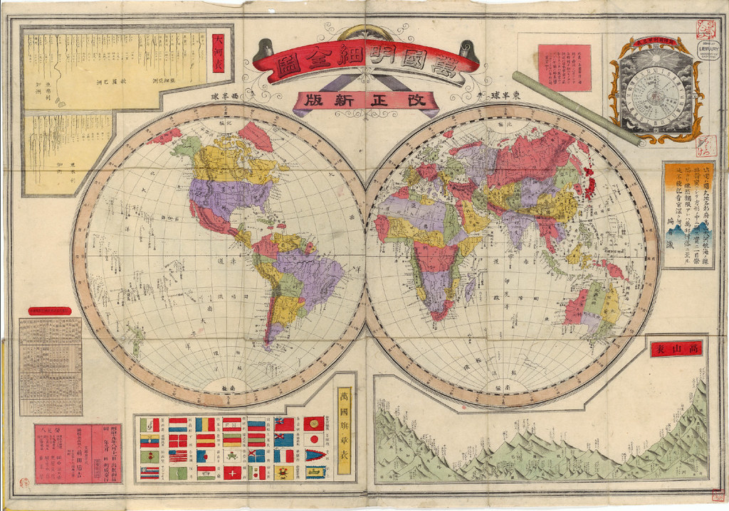 Kaisei shinpan bankoku meisai zenzu : zen / Maeda Torakichi. Meiji 19 [1886]
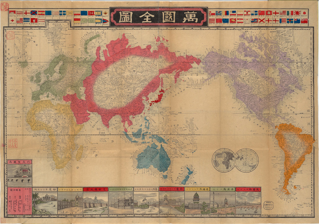
Bankoku zenzu : zen / Yoshimura Sentaro. Meiji 21 [1888]
-
these maps are from
Japanese Historical Maps from the East Asian Library of University of California, Berkeley [
link]
more at University of Texas, Austin's
Historic Maps of Asia [
link]
also see
Japanese Imperial Army Maps Online (in Japanese) [
link]
and Tohoku University Library's Kano collection (in Japanese) [
link]